


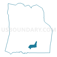
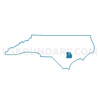
Voting District LOCK, Duplin County, North Carolina
About
Outline

Summary
| Unique Area Identifier | 639921 |
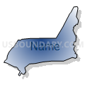
| Name | Voting District LOCK |
| County | Duplin County |
| State | North Carolina |
| Area (square miles) | 11.04 |
| Land Area (square miles) | 10.86 |
| Water Area (square miles) | 0.18 |
| % of Land Area | 98.41 |
| % of Water Area | 1.59 |
| Latitude of the Internal Point | 34.78731170 |
| Longtitude of the Internal Point | -77.87152450 |
Maps

Graphs
Select a template below for downloading or customizing gragh for Voting District LOCK, Duplin County, North Carolina


Neighbors
Neighoring Voting District (by Name) Neighboring Voting District on the Map
- Voting District CHAR, Duplin County, NC
- Voting District CHIN, Duplin County, NC
- Voting District CYRK, Duplin County, NC
- Voting District WALL, Duplin County, NC